Back مقاطعة ريد ريفر (تكساس) Arabic Red River County, Texas BAR Рэд-Рывер (акруга) Byelorussian Ред Ривър (окръг, Тексас) Bulgarian রেড রিভার কাউন্টি, টেক্সাস BPY Red River Gông (Texas) CDO Red River County CEB Red River County Czech Red River County, Texas Welsh Red River County German
Red River County | |
|---|---|
 Red River County Courthouse | |
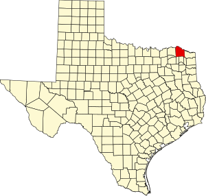
 Location within the U.S. state of Texas | |
 Texas's location within the U.S. | |
| Coordinates: 33°37′N 95°03′W / 33.62°N 95.05°W | |
| Country | |
| State | |
| Founded | 1837 |
| Named for | Red River of the South |
| Seat | Clarksville |
| Largest city | Clarksville |
| Area | |
| • Total | 1,057 sq mi (2,740 km2) |
| • Land | 1,037 sq mi (2,690 km2) |
| • Water | 20 sq mi (50 km2) 1.9% |
| Population (2020) | |
| • Total | 11,587 |
| • Density | 11/sq mi (4.2/km2) |
| Time zone | UTC−6 (Central) |
| • Summer (DST) | UTC−5 (CDT) |
| Congressional districts | 1st, 4th |
| Website | www |
Red River County is a county in the U.S. state of Texas. As of the 2020 census, its population was 11,587.[1] Its county seat is Clarksville.[2] The county was created in 1835 and organized in 1837.[3][4][5] It is named for the Red River, which forms its northern boundary. Red River County was the birthplace of John Nance Garner, 32nd Vice President of the United States.
- ^ "Red River County, Texas". United States Census Bureau. Retrieved January 30, 2022.
- ^ "Find a County". National Association of Counties. Retrieved June 7, 2011.
- ^ "Texas: Individual County Chronologies". Texas Atlas of Historical County Boundaries. The Newberry Library. 2008. Archived from the original on May 13, 2015. Retrieved May 28, 2015.
- ^ "Red River County". Texas Almanac. Texas State Historical Association. May 22, 2015. Retrieved June 23, 2015.
- ^ Cecil Harper Jr. (June 15, 2010). "Red River County". Handbook of Texas Online. Texas State Historical Association. Retrieved June 23, 2015.
© MMXXIII Rich X Search. We shall prevail. All rights reserved. Rich X Search